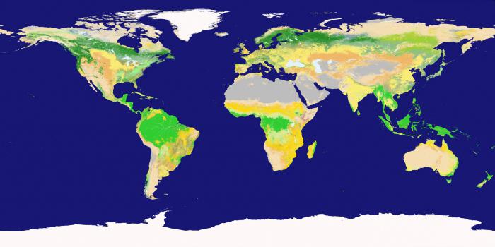
Main sources of geographic information. Geographic map
Basic concepts and terms on the topic: economic and social geography of the world, geographic information system, geographic map, cartographic generalization, statistics, GPS (Global Positional System).
Topic study plan (list of questions required to study):
1. Geography as a science.
2. Traditional and new methods of geographical research.
3. A geographic map is a special source of geographic information.
4. Statistical materials as a source of geographic information.
5. Other methods and forms of obtaining geographic information.
Geographic information systems
Brief summary of theoretical issues:
1. Geography is a spatial discipline. This means that geographers are interested not only in the objects themselves, but also in how, where, and why those objects are placed in space. Economic and social geography of the world is a social geographical science that studies the territorial organization of human society.
2. Obtaining geographic information has real practical implications. The world around us today is permeated with a huge number of information, transport, social and economic connections, ignorance of which inevitably leads to your own isolation. Modern young professionals, entering the global political or economic environment, must have a set of knowledge about the countries of the world, their culture and way of life. Geography uses different research methods: traditional- cartographic, sociological, statistical, mathematical historical, comparative, modern− aerospace, geoinformation, geographic forecast, etc.
3. Maps are the main tools of a geographer. Maps exist for every type of information related to our planet (and beyond). Geographic map (first g.k. was created in Ancient Greece about 2500 years ago by the scientist Anaximander) - a reduced mathematically defined, generalized, figurative-symbolic image of the Earth’s surface on a plane, showing the location, state and relationships of natural and social phenomena. As the scale decreases, a generalization of the objects plotted on the map and their qualitative and quantitative characteristics occurs.
It helps here cartographic generalization- selection and generalization of objects and phenomena depicted on the map in accordance with the purpose and scale of the map. To depict various objects on the map, a wide variety of cartographic image methods are used: methods of high-quality background, areas, traffic signs, isolines, localized diagrams, icons, and dotted. According to the content of the cards, they are divided into: general geographical And thematic.
The first include topographic maps (M 1:200,000 and larger), survey-topographic (M from 1:200,000 to 1:1,000,000), overview (M smaller than 1:1,000,000). General geographic maps show all elements of topographic content ( settlements, individual buildings, roads, industrial, agricultural and socio-cultural objects, hydrography, relief, vegetation, etc..), i.e. everything that “lies” on the ground and can serve as a guide.
Unlike general geographical maps, thematic maps usually reveal one subject (soil, geological structure, population, vegetation, etc.). All thematic maps are divided into two sections - maps of nature (physiographic, geological, climatic, etc.) and maps of social phenomena (political, population, historical, economic, etc.).
4. Statistical materials are one of the main sources of geographic information. Statistics is a science that studies various phenomena and processes in order to take into account and identify patterns of their development using statistical indicators. In the course of geographical research, statistics solves the following scientific problems: collecting statistical data, processing the collected information, analyzing and interpreting data, presenting statistical information in text, tabular, graphical or cartographic form. Statistical information includes absolute and relative values, as well as various coefficients.
5. Modern sources of geographic information also include aerospace and geoinformation sources: aerial photography, space photography, remote sensing, satellite monitoring. A modern satellite system for high-precision determination of the coordinates of static and moving objects is called GPS. (Global Positional System).
It was developed by the US Department of Defense. The project started in 1978, and the final commissioning of GPS took place in 1995. A fundamentally new approach to working with spatial data is associated with the emergence Geographic Information Systems10 (GIS) is a system of hardware for collecting, storing and processing spatial data. We can say that GIS is a complex computer program. GIS capabilities: quick search for necessary information, GIS cartographic ability, ability to model phenomena on the earth's surface.
The volume and quality of socio-geographic information, which is “a body of knowledge and a system of data reflecting the features and patterns of the territorial organization of society, the functioning and development of TPS” 1, become important in conducting research and writing research work.
Among the main requirements that can be presented to socio-geographic information are:
– modernity, i.e. it must correspond to the time interval of the study. However, this condition may not be met when conducting a retrospective analysis of the development of the research object;
– targeting, i.e. information must be tied not only to time, but also to a specific territory. In the study of a real object (process or phenomenon) in the spatial aspect, the geographical individuality of the study is realized 1 ;
– the dynamism of information means its constant change, movement in time and space. The evolutionary development of the object of study is determined by the complication of its structure, the involvement of new functional properties, and the increase in the number of factors of its development. This information should not escape the geographer's field of vision;
– correspondence of the information received to the research topic, and therefore to the stated goal. Its relevance and timeliness become important;
– the objectivity (reliability) of information ensures the reliability of the conclusions obtained and recommendations proposed for implementation;
– verifiability. Some of the published socio-geographic information may be questioned about its reliability (correctness), therefore it is necessary to take a critical approach to the selection of information sources and carry out verification (clarification, check) of the received data through other sources. The researcher must be especially selective in approaching materials published on the Internet.
Taking into account the extensiveness of socio-geographical research, a significant amount of information resources can act as a source of the necessary information, including:
– scientific and literary sources, including scientific and popular science publications, monographs, textbooks and teaching aids, ongoing periodicals and collections of scientific works, dissertations for academic degrees, encyclopedic dictionaries, etc.;
– regulatory sources, including any legal acts of international, state, regional and local significance;
– cartographic or graphical information presenting complex processes in a simplified form;
– results of independent field (full-scale) research and observations;
– statistical sources containing data on the course of a particular process, the “behavior” of the object of study;
– archival and stock materials;
– electronic sources;
– results of sociological research;
– data from monitoring studies.
None of the above sources can become “self-sufficient” for conducting socio-geographic research. In the process of work, a complex of theoretical and applied developments (research) of previous researchers is used, as well as data obtained independently during field work, sociological surveys, collection of statistical information, work in archives, etc.
However, information cannot simply be included in the work. It must be analyzed, verified and interpreted in relation to this study. To perform these operations, the student (master's student) must use the time allotted for production and research practices. The broad goal of conducting practical training is to formulate and solve one’s own research problem, to develop skills in applying knowledge in the field of economic, social and political geography to solve applied problems. That is why industrial practice must have clearly defined goals and objectives corresponding to the topic of the selected original scientific research in each course of study.
During the period of practical training, students (master's students) collect and process primary information - statistical data, cartographic materials, graphic-analytical constructions, historical and geographical information, sociological information, develop an original research methodology and determine a set of indicators for the purpose of a deeper and more comprehensive study of the object and subject of observation etc. The main places for the accumulation and storage of geographic information are libraries, scientific institutions, archives, the territorial department of the Federal Statistics Service of the Russian Federation, regional and municipal authorities, employment centers, various organizations and departments.
A student (master's student) can obtain a theoretical basis for the research being carried out from printed sources of geographic information, which are quite diverse in both content and scale. Particular attention should be paid to monographs both on social geography and related disciplines: physical geography, economics, sociology, political science, resource science, ecology, cultural studies, tourism studies, etc. Conceptual ideas, important theoretical positions and practical (applied) data are contained in other sources, including collections of scientific papers, materials of conferences at various levels, scientific reports, etc. The electronic catalog of printed publications that make up the collection of the scientific library of Perm State National Research University is available free of charge on the website www.library.perm.ru. Here you can also get acquainted with new arrivals, scientific journals in foreign languages, access the websites of the US Library of Congress, the Russian State Library (Moscow), the Russian National Library (St. Petersburg), the All-Russian Institute of Scientific and Technical Information (St. . Moscow) and others.
A special source of geographic information is the abstract journal “Geography”. It contains abstracts of scientific publications in various areas of geographical science, secondary information materials (bibliographic descriptions, annotations, literature reviews) in conjunction with a reference and search engine. To compile it, over two thousand different sources, Russian and foreign, are used. Each issue includes approximately 1,500 abstracts. The abstract journal "Geography" has been published annually since 1952 (12 issues per year). Numbers for 1998 – 1999 and since 2009 they are in the reading room of the Faculty of Geography, the rest are in the scientific and bibliographic department of the Perm State National Research University library.
Another important literary source of geographical information is dissertations for the scientific degree of candidate and doctor of science. The list of dissertations and dissertations themselves in the specialty 25.00.24 (until 2005 - 11.00.02) - Economic, social and political geography, defended at our university, are stored in the periodical literature department of the Perm State National Research University library. To work with them, you must issue a letter certified by the head of the department where the student (master’s student) is studying.
During any work, new scientific categories, concepts, and terms come into the field of view of a young researcher. In this case, a variety of scientific and bibliographic literature is of great help: dictionaries, encyclopedias, glossaries contained in textbooks and teaching aids. Among them, first of all, it is necessary to name the Great Russian Encyclopedia, the Great Geographical Dictionary, toponymic dictionaries, etc.
An important source of information is the most popular scientific geographical journals, collections of scientific works periodically published by scientific and educational institutions. They publish innovative articles of a theoretical, methodological and applied nature. For many years, collections of scientific papers from Tartu, Perm, Tyumen and other universities were published annually. Geographical journals have gained worldwide fame: “Izvestia RAS. Geographical Series" (Moscow), "News of the Russian Geographical Society" (St. Petersburg), "Geography and Natural Resources" (Irkutsk, journal of the Institute of Geography SB RAS), "Geography at school", "USA and Canada: economics, politics, culture”, “Japan”, “Asia and Africa today” (published by the Institute of Asia and Africa of the Russian Academy of Sciences), etc. No less popular are geographical journals published in the country’s leading universities: Moscow, St. Petersburg, Voronezh, Perm, Smolensk, Bashkir, Udmurt, etc.
Important information is contained in periodicals on related sciences: economics, sociology, political science, ecology: “World Economy and International Relations” (published by MGIMO (U) of the Ministry of Foreign Affairs of the Russian Federation), “Russian Economic Journal”, “Bulletin of Economics”, “Polis” ( “Political Research”), “Socis” (“Sociological Research”), “Expert”, etc. The list of journals on geographical and related topics available in the scientific library of Perm State National Research University is indicated in the appendix. 2.1.
With the support of federal ministries and departments, journals are published on individual sectors of the economy: “Oil, Gas and Business”, “Coal”, “Automotive Industry”, etc. In them, a researcher can obtain information about the latest technical and technological developments of domestic and foreign scientists. It also contains some data regarding production, consumption, cost, export-import of goods and services.
When writing papers on regional studies, assistance can be provided by the magazines “GEO”, “Around the World”, “National Geographic Russia”, “Tourism”, “Picturesque Russia”, etc., which contain a large amount of popular science information on individual regions of Russia and the world .
It is important to note that the latest issue of most journals lists all material published during the calendar year. Some of these magazines are located in the reading room of the Faculty of Geography of Perm State National Research University.
Another type of periodical press - newspapers - can also include information of interest to a geographer - the so-called current information. Particularly noteworthy in this regard is the newspaper “Geography”, which is a methodological publication for teachers of geography, ecology and natural history (published since 1992) 1 . Among the central newspapers, Rossiyskaya Gazeta stands out - the official printed publication of the Kremlin (Government of the Russian Federation). It reflects events in both domestic and international life. Special editions of the newspaper dedicated to individual regions, countries or types of economic activity are also quite informative. When conducting geographical research at the micro-, topo- and nano-levels, local newspapers published by municipal authorities can be of great importance. They cover the entire spectrum of life activities of the population in a clearly localized territory, and in this regard they are irreplaceable.
A specific type of information is regulatory and legislative documents, including:
– international legal acts (Convention on Human Rights, Kyoto Protocol, UN Maritime Convention, Antarctic Treaty, etc.);
– The Constitution of the Russian Federation, constitutions and charters of regions - subjects of the Russian Federation; constitutions of specific countries;
– interstate pacts;
– declarations, federal agreement;
– codes, federal laws, laws of constituent entities of the Russian Federation and municipalities;
– acts of the President of the Russian Federation, Chairman of the Government of the Russian Federation;
– annual messages of the President of the Russian Federation to the Federal Assembly;
– acts, laws, resolutions of the chambers of the Federal Assembly of the Russian Federation;
– acts of representative and executive bodies of state power of the constituent entities of the Russian Federation and local self-government;
– charters of municipalities, etc.
Students and undergraduates can familiarize themselves with all of the listed types of regulatory documents using the “ConsultantPlus” program, access to which is available in the reading room, computer class of the Faculty of Geography and departments.
The importance of using legislative and legal literature in socio-geographical research is explained by the need to establish a legal framework for scientific research, determine the official status of a particular real-life object, and formally evaluate a particular process. Socio-geographical research is based on and follows legal norms. However, research results can serve as an important factor in making changes (additions), improving, improving standards and their implementation in practice in national, regional or municipal development.
In addition to literary sources, cartographic and graphic materials become of great importance in research works on economic and social geography. The latter can contain a large amount of geographical information in a concise, easy-to-read form.
The advantage of cartographic material over textual material is that the map is a visual (generalized) model of the territory. It is distinguished by its brevity and information capacity. The map displays connections between geographical objects, phenomena, processes in dynamics or statics. Textual information cannot give the researcher more than what is written in it. The map can illustrate cause-and-effect relationships and territorial differences. Cartographic materials allow us to most fully diagnose social, ecological, economic, planning, service, political, environmental phenomena and processes. This information is used in the process of visual and measurement analysis of maps, decoding and retrieving information data. That is why this kind of material is usually included in literary sources. However, some maps or map diagrams that have thematic homogeneity can be published in the form of atlases or thematic collections. For example, “National Atlas of Russia” (vol. 1–3), “Socio-economic geography of the world” (authors: V.N. Kholina, A.S. Naumov, I.A. Rodionova. M., 2006), “Regions of Russia” (author: A.L. Chepalyga, I.V. Chepalyga. M., 2006).
A large number of anamorphic maps 1, which clearly show the disproportions of world development, are posted on the website www.worldmapper.org in the public domain (in English).
Graphic materials also carry important information reflecting the statics and dynamics of socio-economic processes. Graphs and diagrams provide a visual representation of the state and trends in the functioning of territorial systems and can be considered as sources for diagnosing and forecasting their future development.
Cartographic and graphic materials can serve as a starting point for research, an impulse for scientific research. Having in his methodological research arsenal the necessary approaches and methods, information resources and general knowledge about the course of a process or the nature of a phenomenon, a specialist in the field of socio-economic geography is able to correctly assess and identify development trends and see the promising state of an object. The result of this research may also be a map or a series of maps with a detailed decoding of the encoded information.
Carrying out research work is impossible without the use of statistical data characterizing the quantitative patterns of life of territorial communities of people in all their diversity (economic, social, political, spiritual, cultural development, natural environment) in inextricable connection with their qualitative content.
In global studies, international statistics published by the UN and its specialized organizations, the International Monetary Fund, the World Resources Institute, the World Trade Organization, Eurostat, etc. are widely used. Among the annual collections, it is necessary to name the “Human Development Report”, published by the UN Development Program, “State of World Population" (published by the UN Population Fund), "World Development Report", "World Development Indicators", "Economic and Social Survey" (World Bank), "Report on the World Social Situation" (UN Department of Economic and Social Development ), “World Resources” (World Resources Institute), “State of Food and Agriculture” (FAO), etc. These and other reports are freely available on the UN website (Russian version) - http://www.un.org/russian/esa/surveys.htm.
A large volume of statistical information, updated annually on more than 100 indicators, is contained on the official website of the US CIA - www.cia.gov in the “Factbook” section (in English). The classification of countries by level of socio-economic development is published annually on the website of the International Monetary Fund – www.imf.org in the “World Economic Outlook” section. Financial indicators of the development of countries around the world are reflected on the World Bank website (www.worldbank.org) in the annual reports of Global Development Finance. Statistics on international trade relations are updated annually on the World Trade Organization website (www.wto.org) in the “Resources” section.
Among the Russian research institutes that study international issues and publish some statistical data, it is necessary to name the scientific organizations that are part of the Russian Academy of Sciences: Institute of World Economy and International Relations, Institute of the USA and Canada, Institute of Europe, Institute of Latin America, Institute of the Far East , Institute of Socio-Economic Problems of Population, Council for the Study of Productive Forces (SOPS), etc.
When studying the processes of development and territorial organization of the Russian Federation and its regions, information from statistical collections is widely used: “Russian Statistical Yearbook”, “Regions of Russia”, “Russia in Figures” (published annually), “Socio-economic situation of Russia” (published monthly, in the country as a whole and in individual federal districts), etc.
Industry statistical information published by the Federal State Statistics Service of the Russian Federation (information website – www.gks.ru) is contained in the collections “Transport in Russia”, “Tourism in Russia”, “Healthcare in Russia”, “Small Business in Russia”, etc. .
Geographic studies of the population, geodemographic situation, settlement systems, conditions and living standards of people are usually based on statistical information contained in reports published after all-Russian population censuses (VPN website 2002 - www.perepis2002.ru, VPN website 2010 - www .perepis-2010.ru), statistical collections such as “Demographic Yearbook of Russia”, electronic version of the journal “Population and Society” - “Demoscope-Weekly” (access on the Internet - www.demoscope.ru), etc.
The Federal State Statistics Service of the Russian Federation also prepares collections concerning the relationship between Russia and its partners, for example: “Russia and the CIS Countries”, “Group of Eight in Figures”, as well as collections on federal districts.
Regional studies use statistical data published in the annual statistical collections of the constituent entities of the Russian Federation. The territorial body of the Federal Statistics Service of the Russian Federation for the Perm Territory (information website - http://permstat.gks.ru) annually publishes the following statistical collections: “Statistical Yearbook of the Perm Territory”, “Economic and Social Situation of the Perm Territory”. In addition, the collections “Municipalities of the Perm Territory. Main socio-economic indicators”, “Industrial production of the Perm region” (published annually), “Perm region: socio-economic results” (published monthly), etc.
Statistical data on the state of the natural environment and measures aimed at maintaining a favorable environmental situation can be gleaned from the annual reports “State and Environmental Protection of the Perm Territory”, “State and Environmental Protection of the City of Perm” (since 2000, available on the website “Nature of the Perm region” – www.permecology.ru).
Industry-specific statistical information is also contained in annual reports on the activities of industrial and transport enterprises posted on company websites.
When conducting microgeographic studies, statistical information can be obtained through field (empirical) studies. The most common are expeditionary studies, during which primary “field” observations and collection of primary information about the processes of functioning of territorial systems take place. They are carried out by studying the geography of population, agricultural production, construction industry, transport, service sector, recreational systems, etc. To conduct such studies, the staff of the Department of Socio-Economic Geography developed a special methodology, which has not lost its significance in modern conditions 1 . In this case, statistical information can be obtained directly from an enterprise, organization, local civil registry office, house management, municipality, or by conducting independent observation.
The researcher can obtain subjective information by conducting sociological surveys, interviews, and questionnaires. Sociological methods make it possible to obtain and analyze the opinions of respondents who are local residents (so-called first-hand information). This is qualitative information, which, however, cannot be considered objective, because depends on a large number of factors directly influencing it (primarily related to human individuality).
However, data from opinion polls and questionnaires are an important source of information in recreational, tourism, medical, behavioral, social, and electoral geography. They are indispensable in research that cannot be measured quantitatively (for example, in studies of lifestyles, the image of a territory, the way of life of peoples and ethnic groups, etc.), in the construction of cognitive and mental maps 1 .
Questioning requires the availability of a ready-made questionnaire, which respondents fill out independently. Therefore, the questions formulated must be understandable to the population. At the same time, they must correspond to the topic of the study, and the answers must provide complete information about the phenomenon or process being studied. Therefore, the wording of questions should be brief, extremely clear and convenient for coding data for the purpose of analysis. You should also pay attention to the composition of the questionnaire and the layout of the questions. The sample of respondents must be representative, i.e. correspond to the population of the area, its gender, age, professional, educational composition.
Conducting interviews requires special training of the researcher, who should not impose his own opinion and express his judgments. In this case, you should pay attention to the environment in which the conversation takes place, as well as the state of the interlocutor. Interviews are often repeated to determine changes in the situation or position of the interlocutor.
It is important to note that some studies may be based on comparison and contrast of quantitative (statistical) and qualitative (opinion survey data) information. Such research is aimed at identifying inconsistencies between the real situation and that described in official sources. In this case, the identified facts themselves serve as a source of geographical information about the state and development of the TPS or its individual structural elements.
Another source of empirical information is hiking and travel, during which one gets acquainted with different countries, regions, national heritage, etc.
Archival and stock materials are an irreplaceable source of historical and geographical information. In the archives you can find information about the socio-economic, political-administrative, demographic, cultural state of a particular territory for a certain historical period.
The State Archives of the Perm Territory (SAPK, website www.archive.perm.ru) is a repository of more than 1 million different documents on paper, photo and electronic media related to the economy, social relations, and demographic features of the development of the Perm Territory since the 18th century. until our time. The GAPC stores cartographic and topographic materials. Data on the history, economy and life of the region’s population in the 20th century. can be obtained from the Perm State Archive of Contemporary History (PGANI, website www.permgani.ru). Working in government archives is subject to certain rules that you must familiarize yourself with before visiting the institution. The quantity and quality of information received depends on the correct execution of requests. Partial information about the documents stored in the archives is posted on the official Internet pages. More complete information can be obtained from thematic collections with a list of documents in the archives themselves. Work with documents, as a rule, is allowed only the next day after the request is submitted.
Fund materials are stored in archives, scientific institutions, as well as in the personal libraries of scientists, travelers, local historians, etc. These can be scientific reports, field diaries, dissertations, theses, manuscripts of research articles, etc.
Theses, final qualifying bachelor's theses and master's theses defended at the Department of Socio-Economic Geography since 2007 are issued for use by students (master's students) upon appropriate request. The use of this source of geographic information is advisable at the very beginning of the study in order to become familiar with existing developments in the research field, clearly define the spatiotemporal boundaries of independent scientific research, and clarify any other information. In this case, in the text of the research work it is necessary to refer to the stock materials of the department.
New information capabilities are brought by the computerization of the research process, which became possible thanks to the development of information and communication technologies. The intellectualization of human labor, the transformation of information into the subject of instant transmission, long-term storage and active practical use give rise to the demand for the creation of electronic sources of information.
Among the latter, the global information network Internet stands out, allowing you to obtain the necessary information in the shortest possible time period. Search engine mechanism (multilingual: Google, Yahoo!, Inktomi, AltaVista, Alltheweb, Bing, DuckDuckGo; Russian-language: Yandex, Mail.ru, Rambler, Aport, Nigma, Qip.ru, Guenon; English-language and international: AskJeeves, Teoma, MSN , TinEye, Ask.Com, MyWay, AOL, About.Com, EarthLink, etc.) ensures the opening of a large number of pages of different posting times in different languages. The uniqueness of searching for information on the Internet is due to its immediacy, volume and specific focus. It is important to take into account that obtaining the most accurate information about a phenomenon (object or process) is determined by the correct formulation of the search query. At the same time, it is necessary to remember the shortcomings of online publications 1: one should beware of redundancy of information, its bias, and therefore it is necessary to sample it and check it using official sources.
Among the many information capabilities of the Internet, it is necessary to mention Internet encyclopedias, in which any user can be not only a reader, but also a creator of new articles. The unique multilingual universal online encyclopedia "Wikipedia" (www.ru.wikipedia.org) contains more than 450 thousand pages in Russian in all areas of knowledge (including other languages - more than 13 million articles). Another popular electronic encyclopedia is Krugosvet (www.krugosvet.ru).
“The Great Encyclopedia of Cyril and Methodius” (BEKM) is the most authoritative multimedia encyclopedic publication in Russia, created with the participation of leading Russian scientists: academicians, doctors of science and corresponding members of the Russian Academy of Sciences. The fundamental nature, completeness of content, breadth of coverage and versatility of materials have made BEKM the leader of the domestic market of information and reference literature.
The multimedia format provides a fundamentally new level of presentation of material: the combination of text, photographs, interactive tables, three-dimensional models, diagrams, audio and video fragments makes encyclopedic articles visual, multidimensional and fascinating.
A list of the most popular and useful sites in socio-geographical research is given in the appendix. 2.2.
Electronic sources of information are not limited to online publications. These also include geographic information system (GIS) databases, maps created with their help, electronic catalogs and atlases. The latter have gained popularity and widespread use in recent decades. GIS technologies allow you to perform various manipulations with data, combine various indicators with each other and build appropriate maps. Electronic sources of geographic information are portable. Among the popular electronic atlases we will name the “Social Atlas of the Regions of Russia”, containing extensive analytical information and cartographic materials on a wide range of socio-economic problems of Russia and its regions, various integral indices of social and economic development of the regions of the Russian Federation (developed by the Independent Institute of Social Policy, www.atlas .socpol.ru).
In recent years, information from monitoring observations has become widely used. Many regions have ongoing environmental, social and political monitoring. Monitoring information 1 is most often stored in regional geographic information systems. This information has dynamic properties, because collected regularly, processed and stored for a long time. A dynamic series of information makes it possible to get an idea of the phenomenon being studied not only for a specific date, but also for a long period of time, and therefore, identify development trends and predict future changes.
Modern sources of information significantly expand the possibilities of socio-geographical research and stimulate scientific research in all fields of science.
The combination of various geographical data makes it possible to expand the research problem, conduct comprehensive research, most reliably diagnose the current geosituation in any territory and extend development trends into the near future. At the same time, a significant amount of available information confronts the researcher with the problem of responsibility for the choice of data used, and, consequently, the final results of scientific research. A solution to this problem can be found in the creation of national geoinformation databases, the active use of geoinformation technologies and increasing the motivation for conducting research work.
A geographic map is a reduced generalized image of the earth's surface, showing the location, state and connections of various natural and social phenomena, their changes over time, development and movement in accordance with the purpose of this map.
Geographic maps can naturally be considered as visual figurative and symbolic models. They have the main features of models in general: abstraction from the whole to study a part - a specific territory, specific phenomena and processes; simplification, which consists in refusing to take into account many characteristics and connections and preserving some of the most significant ones; generalization, meaning the identification of common features and properties, etc. These abstractions contribute to a deeper knowledge of the phenomena depicted on the maps.
The first feature of geographic maps is their construction using map projections, which make it possible to obtain from maps correct data on the position, planned dimensions and shape of depicted earthly objects.
The second feature of geographic maps - the use of cartographic symbols as a special map language - makes it possible to:
a) depict the earth’s surface with the desired reduction (i.e., on the desired scale) in order to cover at a single glance the necessary part or even the entire earth’s surface, while reproducing on the map those objects that, due to reduction, are not expressed on the scale of the map, but in their own way the value must be shown;
b) show the relief of the earth’s surface on the map (for example, using contour lines), that is, convey the unevenness of the terrain in a flat image;
c) not be limited to displaying the surface of objects on a geographical map, but indicating their internal properties (for example, on a sea map you can show the physical and chemical properties of water, currents, topography and soils of the seabed, and much more);
d) show the distribution of phenomena that are not directly perceived by our senses (for example, magnetic declination, gravity anomalies, etc.), and make visible connections and relationships that are inaccessible to direct perception (for example, between sources of raw materials and enterprises for their processing);
e) exclude less significant aspects, particulars and details characteristic of individual objects, and highlight their general and essential features (for example, characterize settlements by population and administrative significance, refusing to convey their layout), i.e. resort to abstraction.
The third feature of geographical maps is especially important - the selection and generalization of the phenomena depicted, i.e. cartographic generalization.
Geographic maps have been and remain the main source of geographic information. Maps allow a simultaneous overview of space within any limits - from a small area of terrain to the surface of the Earth as a whole. They create a visual overview of the shape, size and relative position of objects, and allow you to find their spatial dimensions: coordinates, lengths, areas, heights and volumes. Maps contain the necessary quantitative and qualitative characteristics of these objects and, finally, show the connections that exist between them: spatial and some others. These properties explain the meaning and value of cards for practice.
Geographic maps, recording the position, condition and spatial connections of specific objects (phenomena), allow not only to economically and expressively present knowledge about the distribution of phenomena, but also to find patterns in this distribution. In some branches of knowledge, maps are used as the main means of research.
Maps serve as a reliable guide on land and in the ocean, during the movement of troops and on tourist trips, for airship flights and for walking routes.
In military affairs, they are the main source of information about the terrain and a mandatory aid for command and control of troops and the organization of their interaction.
In industrial, energy and transport construction, maps are used as the basis for surveys, design and transfer of engineering projects to nature. Now the most advantageous routes for railways, highways and pipelines are not found in the field, but are outlined using topographic maps in the offices of design organizations.
Maps are widely used in agriculture for land management, land reclamation, measures to increase soil fertility, to combat erosion, and in general for accounting and the most correct, effective use of all land funds.
Maps constitute an indispensable aid for school and out-of-school learning. They are not only a repository of accumulated geographical knowledge, but also an effective means for their dissemination and the rise of a common culture. Without exaggeration, it is fashionable to say that maps are used to one degree or another in all spheres of human activity.
Maps have acquired great importance as a means of scientific research, especially geographical research. Each geographical study, in one way or another, proceeds from existing maps and provides materials for their implementation and improvement. The scope of use of maps as a means of scientific research is rapidly expanding as the overall pace of scientific progress increases. In particular, this expansion is facilitated by advances in the development of computer science and in the development of modeling theory.
The study of computer science on the general problems of collecting, storing and transmitting knowledge allows us to more fully appreciate the merits of geographic maps as a special form of processing, presentation and analysis of spatial information. As noted, these advantages lie in the possibility of a one-time, holistic perception of cartographic images, the visibility of territorial differences and the convenience of analyzing spatial combinations, relationships and patterns.
The modeling method in geography, geographic information and remote sensing methods are based on the cartographic method. The vigorous introduction of modeling methods into modern science has revealed, when applied to cartography, the real power of maps as generalized and simplified spatial images of the real world, that is, its models reflecting those aspects, properties and processes of reality that are important for the purposes of specific research. Maps allow us to gain new knowledge, study development processes and predict many phenomena. Developing methods for using maps as a research tool is one of the main tasks of modern cartography.
Despite the introduction of new methods into geography, the cartographic method is one of the main ones when conducting research. And although now maps are often stored in computer memory and are parts of geographic information systems that receive information from satellites and from numerous weather stations, including data banks containing reports on the results of the work of many research teams, the map remains the most advanced way of transmitting spatial information.
For a long time, people have been interested in what lies beyond the horizon - new territories or the edge of the earth. Centuries passed, civilization accumulated knowledge. The time had come when scientists who had never been to distant lands knew a lot about them. Sources of geographic information helped them in this.
This article will tell you what they are, as well as their varieties.
General concepts
As you might guess, these are the names of all of which a person can obtain the information he is interested in. What sources of geographic information does 5th grade (in secondary school) consider? Let's list them:
- All geographical maps, atlases, as well as various topographic plans, including military ones.
- Various geographical descriptions of a specific area.
- Directories, encyclopedic articles, results and reports of various expeditions.
- Aerial photographs and space
- and GPS/GLONASS.
These are the sources of geographic information that 5th graders in an average secondary school know. We will try to consider the characteristics of some of them in a little more detail.
Modern technologies
In recent years, more and more sources have been converted from paper to digital form. And this is not surprising. Almost all 5 sources of geographic information that we just talked about can now be found in digital form. Even professional scientists in recent years have preferred to work with digital data.

It is much more convenient to work with the same GIS system than with a pile of books. Now let's discuss some sources of geographic information in more detail.
Cards
A map is a schematic generalized image of the surface of a certain area of the earth, the entire planet or celestial bodies. It is built on the principle of scaling, that is, mathematical methods are used for this. Depending on the scale, all maps are usually divided into three large groups:
- Large scale.
- Medium-scale.
- Small scale.
If we talk about the first category, then the ratio of these documents can be 1:200,000 or larger. This includes almost all topographic plans. All maps with a ratio of less than 1:1,000,000 are considered small-scale. A typical geographic atlas includes either small-scale or medium-scale plans, which are best suited for studying a particular area.
Sorting map information
You should know that long before creating a map, experts make a strict selection of what will be depicted on it. This process is called as follows: cartographic generalization. Naturally, the most stringent selection exists for small-scale maps, since they need to contain the maximum amount of useful information with the minimum occupied document area. In the generalization itself, the direct purpose of the card, as well as the wishes of its customer, play an extremely important role.
Site plans

This is the name for terrain drawings that are made on a large scale (1:5000 or more), and are drawn using special symbols. In this way they resemble a school geographical atlas. The construction of such plans is carried out on the basis of visual, instrumental measurements, aerial photography, or a combined method.
Since the plans indicate relatively small areas of the earth's surface, when creating them, the curvature of the planet can be neglected. It should be clearly understood that these sources of geographic information that we have just described are fundamentally different from each other.
The main differences between plans and maps
- A centimeter of plan rarely contains more than five real kilometers on the ground. They are much more detailed than maps, in one millimeter of which hundreds of kilometers of the earth’s surface can be laid out.
- All objects on the ground are depicted in the plans in as much detail as possible. In principle, all more or less significant areas are marked on the average drawing. Thus, on the topographic plans of the General Staff of the Armed Forces of the Russian Federation (and the USSR, of course), even trees and small streams can be displayed. It is impossible to fit all this information onto maps. Actually, this is why the generalization that we talked about above is carried out. Even the exact outlines of the continents cannot be displayed on many maps, and therefore they are often plotted with significant distortions. In addition, the additional geography literature described above uses out-of-scale conventions.
- Let us emphasize once again that when constructing a plan, the curvature of the earth's surface is neglected. Maps, especially on a small scale, must take this into account.
- There is never a degree grid on plans. At the same time, there are parallels and meridians on each of them.
- The plan is always easy to navigate. The top of the document is north, the bottom, respectively, is south. On maps, the direction is determined by parallels.
Methods of depicting objects on plans and maps

Conventional signs in this case are generally accepted options in which the characteristics of the objects depicted on the map or plan are encoded. With their help, you can display both something concrete (a mountain, for example), and something completely abstract, conditional (population density in a city, village, etc.). Of course, they all make life much easier for a person who knows the basics of cartography and knows how to read these drawings.
How long does the card remain valid?
Almost all geographers and geologists ask this question at least once in a while. The specific answer to it depends on the purpose, scale, and author of the plan. Thus, medieval researchers often drew maps literally “on their knees,” so there is no need to talk about their accuracy. But the maps of the General Staff, despite the time, are still amazing in their accuracy.
Do not forget that the maps are characterized by fairly high stability, while the plans of the Amazon and the Nile can be safely thrown away fifty years after their publication. These rivers change the topography of the Earth's surface so effectively and quickly that older documents are only useful from a historical perspective.
Geographical descriptions, discoveries
All sources of geographic information discussed above are somewhat dry and uninteresting. It is much more interesting to read a description of a region, locality, or even a continent, written by the person who discovered it all!
Jokes aside, but descriptions and reports on geographical (geodetic, biological) research can sometimes provide much more information than the most detailed topographic plan of the area. Moreover, the latter does not reflect some unpleasant features of a particular area (malaria, which is found in some central regions of Africa at every turn, for example).
The list of literature on geography that students are given at school (for example, Nikolina V.V. Geography, Lesson developments; Samkova V.A. We study the forest; Forest Encyclopedia: in 2 volumes / chief editor G.I. Vorobyov ), in fact, was formed thanks to the works of researchers who at one time recorded all this information on a map, being in the thick of things.
Brief information about the discovery of Africa
Let's tell you a little about the history of the discovery of the Dark Continent. Of course, the word “discovery” is not entirely correct here: Australia - yes, I had to suffer with it. In the case of Africa, the coastal areas where they caught black slaves and bought ivory from Arab traders were well explored, but almost no one knew what was going on in the depths of the continent.
Everything changed in the 19th century, when the legendary man arrived in Africa. It was to him that the honor of discovering the sources of the Nile and the magnificent Lake Victoria belongs. Few people know, but at one time the Russian scientist V.V. Junker (in 1876-1886) was engaged in the research of Central Africa.
For the indigenous population of the mainland, all this ended sadly: the main sources of geographical information (that is, maps), the data for which all these brave scientists collected with such difficulty and constant danger to their lives, began to be actively used by slave traders...
So, we are actually done with maps and plans. Geographic atlases fall into the same category. What is the role of modern sources of geographic information? To answer this question, let’s consider the principle of sharing old paper maps and a navigator, which is now actively used even by professional geographers and geologists.
GPS/GLONASS + maps

It should be noted that this method is excellent for determining the accuracy of maps, atlases and topographic plans. In addition, this technique satisfies the needs of historians, since they can see with their own eyes how much the area has changed, which is described in historical chronicles by contemporaries of certain events. However, literature on geography often contains plans of the area that have not been updated since the beginning of the last century.
To use such an accurate, but rather labor-intensive and somewhat extravagant method, you will have to perform three references (three different maps) to the same area of the terrain:
- First, find a more or less modern map or topographic plan.
- It is advisable to have with you a recent aerospace photograph of the area under study with a topographic reference to the coordinate system.
- Finally, you need the card whose information you are going to check.
The point of this operation is to enter all three of these terrain drawings into the navigator’s memory. Modern models of such devices have a fairly powerful processor and an impressive amount of RAM, so you can switch between cards instantly.
Determining the route
It is best to plot your route using a modern map or topographic plan. We do not recommend using old documents for this. It is quite possible that in place of the swamp there is now a passable area, but you will no longer be able to walk along the edge of the once rare young forest, since the geography of the area has radically changed. A map is good, but in most cases such documents are not very accurate.
Why are aerial photography and satellite imagery preferable to maps?
But why are paper drawings so inferior to modern technology products? This is due to the following two reasons:
- Firstly, the relevance of space photography or aerial photography in most cases is much higher. When else will cartographers be able to carry out the next generalization of new data and release up-to-date terrain plans?
- In the pictures you can literally determine the characteristics of a particular area in real time. On a map or even a topographical plan, the tree species in the forest will be displayed only schematically and only in general order. Simply put, stumbling upon a dense spruce forest in the middle of a birch forest is quite possible, but in a dense coniferous forest it is much easier to get lost.
After choosing a route and checking the new photographs, it is recommended to refer to the old map. Why such difficulties? Imagine that you are a biologist in the field. You need to determine how much the forest has grown, what new tree species have appeared, how many types of forest have changed over all these years. The ideal solution to all of these problems is to simply overlay the new map onto its old counterpart. Thus, everything becomes visible as clearly as possible.

These are the sources geography uses. The map is perhaps the most important of them, but we should not forget that over the past decades science and technology have made huge strides forward, and therefore it would be stupid not to take advantage of all modern achievements.
Conclusion
So you have found out which sources of geographic information are currently the most relevant. Oddly enough, we still use all the same plans and maps that were invented before our era. Of course, adjusted for their modern appearance.
Geographic information systems. Geographic information is constantly used in management, planning, forecasting, socio-economic development, and everyday life. On the basis of geographic databases (DBs), geographic information systems (IS) are formed - “repositories” of geographic knowledge about territorial organization and the interaction of society and nature created with the help of a computer. PS is an automated system for storing, analyzing, and presenting spatial data in the form of text, tables, graphs, maps (Fig. 2). The PS includes: computers, software, spatial information in the form of cartographic data about natural components, farms, lands, roads, etc. They are automated systems that operate spatially coordinated information. The functioning of the PS is carried out in the following sequence: collection and automated processing of geographic information, its spatial reference and presentation in the form of an electronic map on the display screen, translation of this map into paper form if necessary (for example, creating atlases).
Based on the size of the territories covered, PSs are divided into global, national, regional, local, and local. They are used to compile geographic maps, cadastres of natural resources, engineering surveys and design, form management decisions, they are also distinguished by individual objects and areas of research: geographical, environmental, land, property, forestry, water resources, recreation, tourism, etc.
The Institute of Geography of NASU is developing a multi-purpose National PS of Ukraine, the purpose of which is to create a geographical-cybernetic model of the region. At the Taras Shevchenko National University of Kiev, automated cartographic systems based on digital maps and three-dimensional computer models of modern urban landscapes of Kyiv are being studied.
An important component of the aircraft is aerospace information, data from aerovisual observations, ground sensors, etc. Such information systems are called integrated. Their databases combine cartographic data with remote sensing images of the Earth's surface, they have receiving units and programs for processing aerospace materials. PS databases are formed from many sources of geographic information. These include textbooks, teaching aids, maps and atlases, scientific reports on the results of geographical research, statistical reference books on the development of the country's economy, encyclopedias, dictionaries, the results of geographical research published in books, scientific journals, observation data carried out by government agencies: geological and hydrometeorological, geodesy, cartography and cadastre, other institutions and departments.
Geographical studies. An important source of geographic information is expeditionary research, travel, local history excursions, tourism, and mountaineering. Field expeditionary research can be expeditionary or stationary. Expeditionary is the study of individual natural components, branches of the economy (geomorphological, hydrological, geobotanical, oceanic), which cover large areas and water areas). Natural and economic complexes and regions are studied in the process of comprehensive geographical research (natural-geographical, landscape, economic-geographical, natural-resource, environmental). Expeditionary research is carried out by teams of scientists using specially developed programs and methods and is divided into three periods: preparatory, field expeditionary and office (processing of collected materials, writing a report, drawing up maps). During expeditionary research, aerospace photographs of the earth's surface taken from aircraft and spacecraft are used. Aerospace images are deciphered - the objects reflected on them are recognized by their shape, color, and tone of the image. A view of the Earth from Space embraces it
large tectonic structures, deserts, river basins, areas difficult to reach by land expeditions. Satellites provide the opportunity to study the dynamics and periodicity of natural processes, unique phenomena and objects (volcanic eruptions, fires, avalanches, landslides, crustal faults, atmospheric pollution, etc.). From cosmic heights a new world, hitherto unknown to us, opens up, new patterns of natural conditions, features of urbanization, temperature inhomogeneities in the seas and oceans, forests.
Rice. 2. General scheme of PS operation
In 1995, the first Ukrainian satellite "Sich-1" was launched, equipped with instruments for remote sensing of the Earth, inventory and assessment of land, mineral exploration, meteorological forecasting, and environmental monitoring. Ukraine cooperates with space agencies of the European Community, Russia, Germany, France, and Latin America on space research of natural resources and nature conservation. In Ukraine there are the Center for Aerospace Research of the Earth, the Center for Radiophysical Sounding of the Earth, and the Marine Hydrophysical Institute.
They obtain geographic information about natural and man-made processes, changes in the natural environment, geochemical anomalies, cities and suburban areas, air pollution, flooding, quarries, abrasion, the state of vegetation, areas of radioactive contamination, emissions from wastewater treatment plants, etc.
Stationary geographical research has been carried out regularly for many years at specially equipped geographical stations. They study in detail changes in natural complexes over time. In Ukraine, such scientific complex physical-geographical studies were started by Academician G. Vysotsky at the Velikoanadolsky station to study the influence of hydroclimatic and soil conditions on afforestation in the steppe zone of Ukraine. Stationary geographical research is carried out at the Institute of Geography of the National Academy of Sciences of Ukraine, Kyiv, Lvov, Odessa, Kharkov, and Tauride universities.
Monitoring of the state of the atmosphere and hydrosphere is carried out at hydrometeorological stations and posts staffed by young specialists in meteorology and climatology, hydrology and hydroecology, and oceanology. More than 5,000 employees work in the institutions of the Hydrometeorological Service of Ukraine. There are about two hundred hydrometeorological, aviation, aero- and agrometeorological stations in Ukraine. Observations are carried out at 400 hydrological posts on the state of rivers, lakes, reservoirs, and sea estuaries. Along with them, agrometeorological indicators are recorded at 150 points, ozonometric and radar studies of the formation of clouds, precipitation, air, water, and soil pollution are carried out.
Our state has membership in the World Weather Watch, the World Meteorological Organization. Hydrometeorological conditions are important economic and social factors: the social and economic state of the state, the environmental situation, the AGRICULTURAL PRODUCTION complex, energy, transport, utilities, military security, and recreation depend on them. The sources of geographic information are local history studies and descriptions of the native land, cities, and other settlements. They also serve as descriptions of travel, tourist and mountaineering routes, and excursions.
Essential components of geographic information are maps and atlases. Maps are the second language of cartography. Cartographic images convey and reproduce the dimensions and properties of geographical objects using geographical means and signs (lines, dots, shapes) and a colored background. Combinations of graphic signs and background are means of cartographic modeling, creating cartographic images (geographic images). To understand the natural and economic objects displayed on the map, components of natural conditions, processes, and patterns of their distribution, legends are attached to the maps. The text of the legend, geographical names, terms and concepts allow you to “read” the map, use it, and find new facts on it.
Maps are the most important components of the information structural blocks of geographical atlases. Geographers and cartographers have significant experience in compiling complex and sectoral, scientific, reference and educational atlases. National atlases are acquiring exceptional importance. By Decree of the President of Ukraine L.D. Kuchma dated 08/01/2000 “On the National Atlas of Ukraine”, a new cartographic work is being created - the National Atlas of Ukraine. It will reflect the spatial characteristics of natural conditions and resources, population, economy, environmental conditions, science and culture of Ukraine. National atlases are integral cartographic models of states as natural resource and socio-economic territorial systems. The national atlas of Ukraine should provide geographic information to the state, its regions and their governing bodies, scientific, educational, design, production and public institutions, help disseminate geographical knowledge about our state, and promote its cooperation with other countries of the world.
Geographic information is produced by the Institute of Geography, Institute of Geological Sciences, Institute of Botany, Institute of Zoology, Council for the Study of the Productive Forces of Ukraine, regional natural science and socio-economic divisions of the National Academy of Sciences of Ukraine. A variety of geographical information is stored by the National Natural Museum of Ukraine, regional, district, and city local history museums. Geographical research is carried out by scientific laboratories of universities, scientific departments of natural and natural-historical reserves, national natural parks, and biosphere reserves. A variety of geographical information is available in statistical reference books, dictionaries, encyclopedias, scientific journals, and periodicals. The results of scientific research, descriptions of travel, regions of Ukraine and the world are presented in the "Ukrainian Geographical Journal" (founded in 1992), the Journal "Geography and Fundamentals of Economics at School" (published since 1995), the Weekly "Local History. Geography. Tourism" "(published from J996 p.), scientific bulletins and collections that are published by scientific institutions, universities, nature reserves, published as materials of scientific conferences, geographical congresses, etc.
The media are filled with geographic information: newspapers, radio and television programs. Geographic popular science, documentaries, and educational films are created. The Internet provides great opportunities for obtaining and using up-to-date geographic information. We find geographical descriptions and pictures in popular science and fiction literature, works of painting, landscape architecture, etc.